worm:
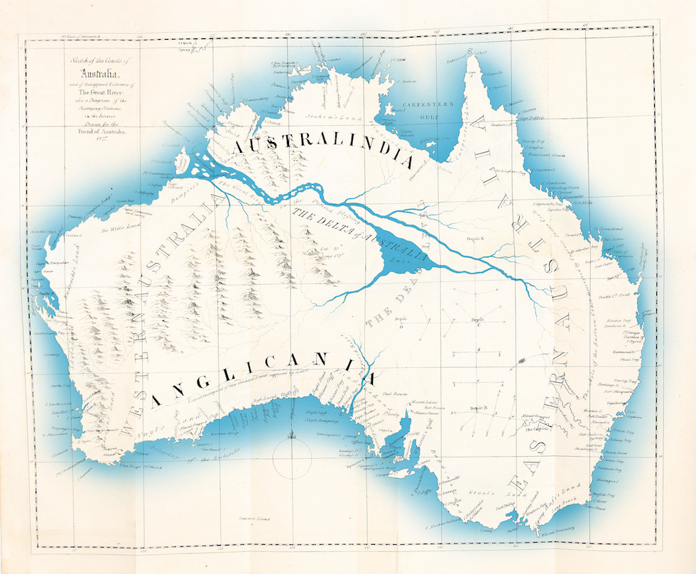
Thomas J. Maslen imagined a big river in the middle of Australia, 1830.
thomas j. maslen: *drawing a massive big river in the middle of his map* sick, I hope that’s real
@navigatorsnorth Nav is the government hiding a huge river from us? Nav I demand answers!
I’m not at liberty to say.
Non-Australians being shocked and confused by the ‘inland sea’ hypothesis is kind of wild to me. Most of the history of white explorers that I learnt by the age of ten was, ‘they went west/north/south and expected there to be water, there wasn’t, they died’. The idea that there was some massive body of water in the middle was incredibly pervasive, and there just wasn’t one map with a sea or river drawn like that. The closest thing we have is
Kati Thanda. It’s a salt pan which occasionally gets filled with water once in a blue moon (the birds come from hundreds of miles around when it does), but it is in NO WAY drinkable, or surrounded by bountiful, arable land like the early white people hoped. You can live in the red centre, but you have to do it lightly, knowing how to find water, what is safe to eat, and moving when you need to. That’s what the Aboriginal people did for seventy-odd thousand years, before white people came (and what many still do, when on their country/traditional lands).
If you want to know more about the inland sea theory Passing Strangeness has a good blog post here.
